About us

Home

Contacts

Address:  48, str. Serghei Lazo, Chisinau, Republic of Moldova, MD-2004
Schedule: 8.00-17.00
Agency for Geodesy, Cartography and Cadastre of the Republic of Moldova
www.arfc.gov.md

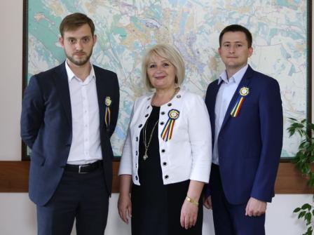
Mr.Ivan Danii, General Director AGCC
Mr.Stefan Crigan, Deputy General Director AGCC
Mr.Valeri Perceamli, Deputy General Director AGCC
Phone: +37322 881255
Fax:+37322 226373
E-mail: info@agcc.gov.md

Mrs.Maria Ovdii, Department Geodesy, Mapping & GIS
Phone: +37322 881270
E-mail: maria.ovdii@agcc.gov.md

Mrs.Tamara Rudenco, National Geospatial Data Fund:
Phone: +37322 881266
E-mail: tamara.rudenco@agcc.gov.md
www.geoportal.md
https://geodata.gov.md/


Agency for Geodesy, Cartography and Cadastre (AGCC)

Agency for Geodesy, Cartography and Cadastre (AGCC) was founded on July 27, 1994 by Decree No. 230 of the President of the Republic of Moldova, for the purpose of the developing and promoting the state policy and strategy in the fields of land relations, cadastre, geodesy, cartography and soil protection, ensuring the branches of the national economy and the functions of defense and security of the state with current geodetic, cartographic and cadastral data and the creation of the State Cartographic-Geodetic Fund (National Geospatial Data Fund).

 
On the 25th anniversary of the establishment of the Agency has been developed within the legal and technological knowledge necessary for the creation and implementation of the national systems of land cadastre, land relations, geodesy and cartography. 
By the year 2017, Agency for Land Relations and Cadastre has de function of the founder in four state enterprise 
1) State Enterprise "CADASTRU";
2) State Enterprise Institute of Geodesy, Engineering Research and Cadastre "INGEOCAD"; 
3) State Enterprise Project Institute for Land Management "IPOT"; 
4) State Enterprise "Soil Protection and Land Development."

As the organizational structure unique to the agency, the Agency for Geodesy, Cartography and Cadastre, in co-operation with the state-owned enterprises, functioned as a structure for integrated, coordinated, efficient, and innovative, in line with the legal framework of the Directives of the European Union, the INSPIRE, occupying a position of leadership in the post-soviet space. 

2017 was a year of significant changes in the Government of the Republic of Moldova. As a result of the reforms, the State Enterprise "CADASTRU" was merged with the Public Services Agency, and in 2018 State Enterprise Institute for Land Management "IPOT" and State Enterprise "Soil Protection and Land Development." were passed to the Public Property Agency, only " INGEOCAD " remained subordinated for the ARFC.

As a result of the consultation, the documents for the policy baseline, according to the activity of the Agency for Land Relations and Cadastre, in part related to the competence of the institution, as well as having regard to the recommendations and the views of partners and interested bodies have been established, for the period 2018-2022, the following priorities: 

• development of  legislative and regulatory framework in the areas of activity;
• execution of  works for rehabilitation of degraded lands;
• execute ongoing massive cadastral works, massive primary registration of real estate and rights on them;
• continuing implementation of the new system of evaluation for tax purposes and the development of an automated system for effective evaluation, unique to the whole territory of the Republic of Moldova;
• completion of the demarcation of the state border between Moldova and Ukraine;
• coordinating the creation, modernization and maintenance of the  state geodetic network, national leveling network, gravimetric and national positioning system;
• coordination of activities related to the creation, storage and distribution of geospatial data to all levels of government by implementing national spatial data infrastructure;
• implementation of new technologies in the areas of activity and improve public services provided, efficiency and facilitate participation in National e-Government platform 

The activity of the current day of the specialists of the Agency for Geodesy, Cartography and Cadastre and those who works in subordinated institution, as well as engineers, land surveyors, cartographers, geodesists, geologists, computer programmers, pedologists, evaluators, administrators, economists, legal experts in the field, and other experts, has a great contribution for the sustainable development of the national economy.

Department for Geodesy, Mapping and Geoinformatics 


is the subdivision of Geodesy, Cartography and Cadastre Agency, responsible for the coordination and management activities related to the promotion of state policy in the field of geodesy, cartography, geoinformatics and spatial data infrastructure. (SDI).
General and specific objectives:
I) creation, development and updating of the regulatory framework in the field of geodesy, cartography, geoinformatics and National Spatial Data Infrastructure;
ii) creation and maintenance of the National Geodetic Network (NGR), the National Leveling Network (NNR), the National Gravity Network and the National Positioning System MoldPOS;
iii) demarcation of the State border between the Republic of Moldova and Ukraine; 
iv) creating and updating spatial reference data and digital maps; 
v) coordination and monitoring activities for creation of national spatial data infrastructure and the integration the Republic of Moldova to the European Community, through the development of public spatial data;
vi) development of international collaboration.

National Geospatial Data Fund


For the purposes of centralized accounting, keeping and use of topographical, geodetic and mapping documents there has been created National Geospatial Data Fund storing the respective materials for the whole territory of the Republic of Moldova. These materials are of technical, scientific, economic, historical, social and cultural interest. Topographical, geodetic and mapping materials and data are distributed for use to public authorities and private sector on demand, observing the Fund Regulations.

Development of the digital database in the National Geospatial Data Fund - http://geoportal.md, that includes scanned topographic maps at different scales, geodetic networks, digital maps, orthophoto.

Development and implementation of Web-services in order to provide access to the geospatial data for public authorities, private sector and citizens.