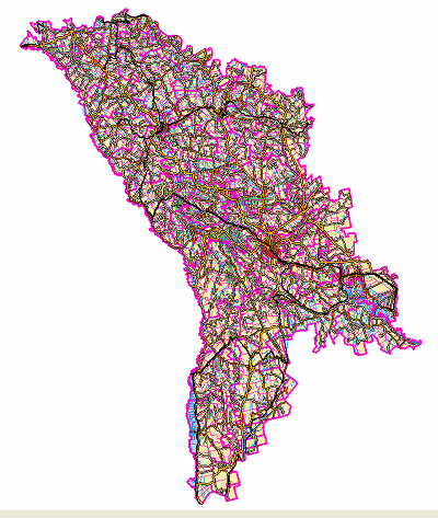
Digital maps
HomeEURO GLOBAL MAP
EuroGlobalMap is now available as open data.
Represent a unique multifunctional topographic database on the territory of Europe of the scale 1: 1 000 000.
Data for the base EuroGlobalMap are created with the support and participation of National cartographic and cadastre Agencies of the European countries.
Content of the database.EuroGlobalMap data is grouped in 6 thematic layers:

- Administrative boundaries
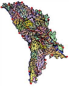
- The water network
- Tranport networks
- Settlements
- Elevation
- Names locations
- Ellipsoid –WGS 84
- Heights system – Baltic
- Reference coordinate system – WGS 1984, geographic coordinates in degrees (latitude, longitude) with decimal quota
- Measurement unit – meters. The heights are measured in meters, surfaces – in hectares, azimuths and angles – in degrees
EURO REGIONAL MAP

Represent a unique multifunctional topographic database on the territory of Europe of the scale 1: 250 000.
Data for the base EuroGlobalMap are created with the support and participation of National cartographic and cadastre Agencies of the European countries.
Content of the database.EuroRegionalMap data is grouped in 7 thematic layers:
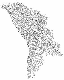
- Administrative borders
- Aquatic network
- Transport network
- Different objects (electricity lines, towers, monuments
- Localities
- Soil and vegetation;
- Names of geographic objects
- Ellipsoid –WGS 84
- Heights system – Baltic
- Reference coordinate system – WGS 1984, geographic coordinates in degrees (latitude, longitude) with decimal quota
- Measurement unit – meters. The heights are measured in meters, surfaces – in hectares, azimuths and angles – in degrees.
EURO BOUNDARY MAP

Represents a common European database containing geometric and semantic 0information on the administrative division of 36 European countries. The executed works allow the integration in the respective database of the data for further cooperation.
Content of the database.The data of EURO BOUNDARY MAP is grouped in two layers:
- Segments of Administrative Boundary
- Administrative Area and data table:
- Name table of administrative units
- Ellipsoid –WGS 84
- Reference coordinate system – WGS 1984, geographic coordinates in degrees (latitude, longitude) with decimal quota.
EuroDEM

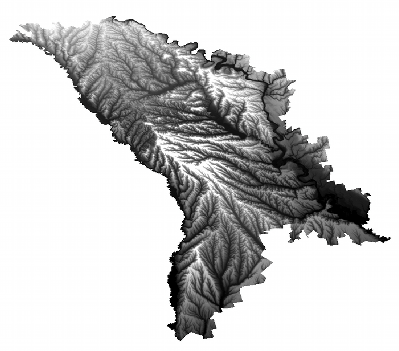
Represents the digital representation of the ground surface of the territory of Europe.
Data for the base EuroRegionalMap are created with the support and participation of National cartographic and cadastre Agencies of the European countries.
Content of the digital model of the relief:
The product describes the surface of the Earth, without including such heights as vegetation or artificial constructions. This means that EuroDEM describes the theoretical surface of the Earth.
Mathematic background of the project:
- Coordinate reference system vertical –ETRS 89.
- Heights reference system – EVRS.
- Cartographic projection - Lambert equal area LAEA 52N10E
Digital map at the scale 1:200 000

Contains all the elements of a digital topographic map from 2000 (the issue year), with updated data, received from FAO project.
Objects and attributes are brought to accord with the DIGEST standard and are conform to the classifier FACC version 2.1.
The map is designated for the solution of national and general tasks, as well as for the use in geo-informational and navigation systems.
Content of the database.Data is grouped in 8 thematic layers:
- Administrative borders
- Aquatic network
- Transport network
- Industrial and agricultural objects
- Localities
- Soil and vegetation;
- Relief and forms of relief
- Names of geographic objects
- Ellipsoid –ETRS 1980.
- Height system – Baltic.
- Cartographic projection – (UTM), zone 35
- Coordinate units - meters
Digital Map 1:50 000
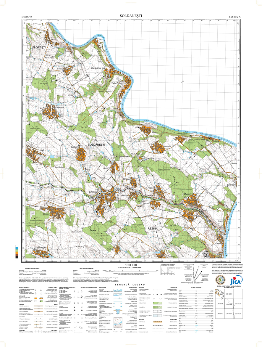
Digital Map 1:50 000 is part of the project "Basic digital map for developing the National Spatial Data Infrastructure of the Republic of Moldova" and is funded by the Japanese Government.
Mathematic background:
- Ellipsoid –WGS 84
- Heights system – Baltic
- Reference coordinate system – WGS 1984, geographic coordinates in degrees
- Measurement unit – meters
Digital map in two formats: in ArcGIS format (file geodatabase) and Adobe Illustrator
Geogdatabase contains 27 layers, grouped into 10 themes:
Administrative_Boundary
Airport
Buildings
Construction
Control_Point
Hydrography
Landform
Heath
Transportation
Utility
Paper sheets in Adobe Illustrator format is ready to print with layouts 90х65 cm with 222 layers of objects and inscriptions representation to the paper.
Line maps for development
Project
“Line maps for development” was funded by Norwegian Government.
Line maps, orthophoto 40 resolution and laser scanning data covers 20% of
the territory of the Republic
of Moldova.
The flight area covers a total of approx. 6242 km? (central part of
the territory of Moldova.)
Quality control is performed by S.E.INGEOCAD and Norwegian Cadastre Authority
"Statens Kartverk"